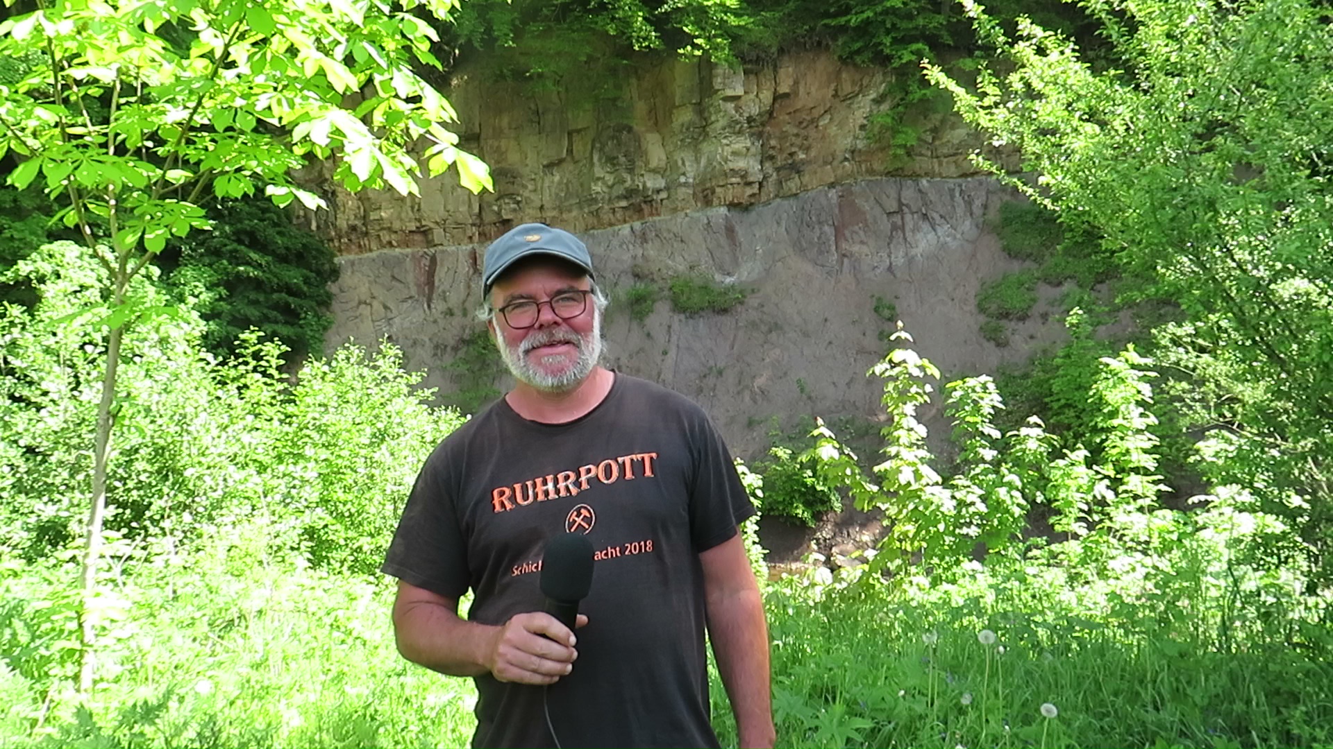
by Dipl.-Geol. Helmut Garleb, Dr. Klaus George with kind permission by Regionalverband Harz
TL;DR (Too long; did’nt read)
The “Lange Wand” is like a window into Earth’s history: from the Ilfeld porphyry (280 million years) to the copper shale and the Zechstein limestone (250 million years). In the mine of the same name, copper shale has been mined since the 16th century. Here, in addition to cobalt ore and barite, you can also admire fish fossils, the so-called “copper shale herring”.
At the bottom of the Zechstein sea

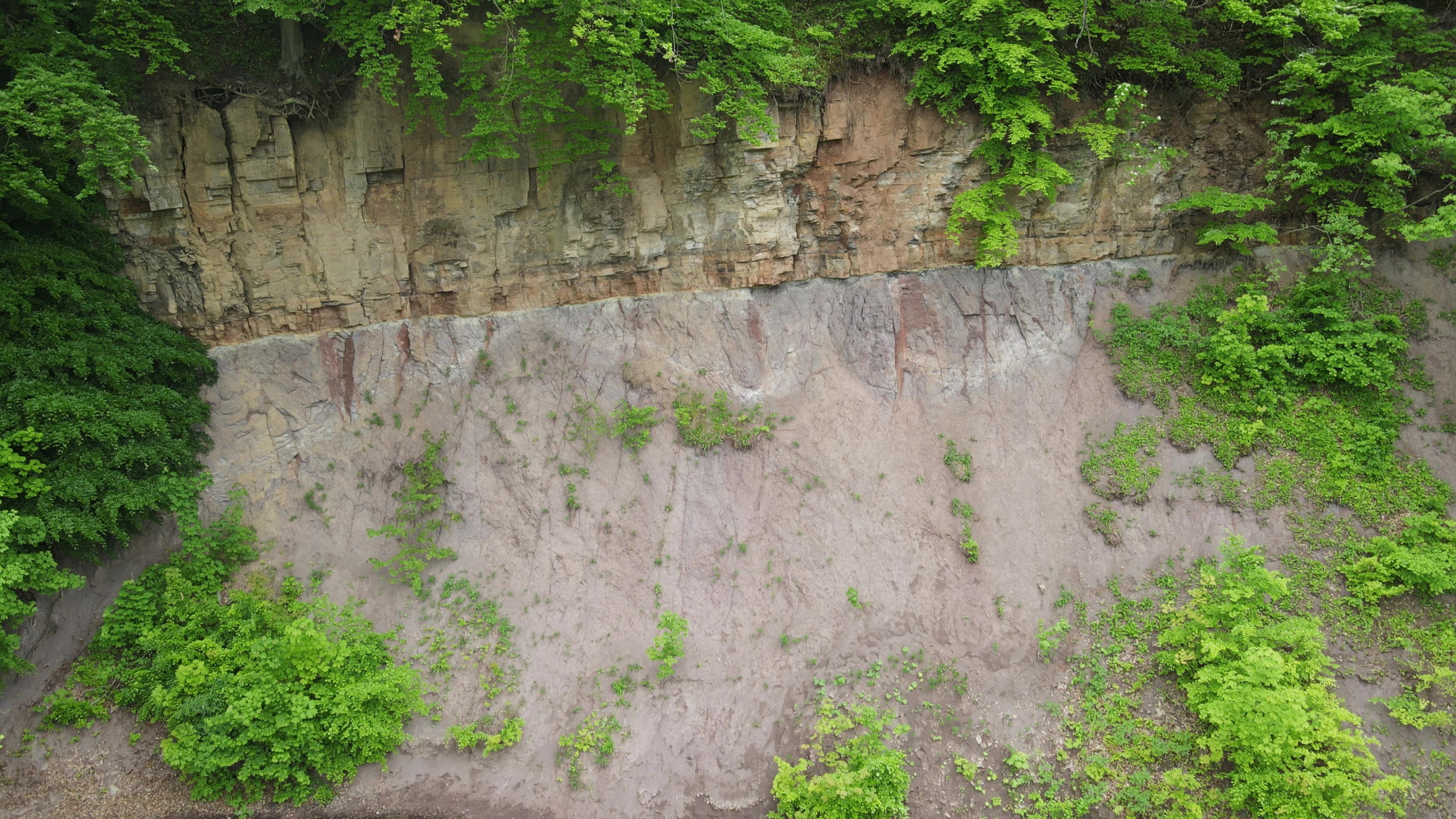
The “Lange Wand”, located south of Ilfeld, can be reached via a municipal road from the railway stop of the Harzquerbahn “Ilfeld Scheibenwiese”. The steep slope along the left bank of the river Bere is a classical geological exposure where magmatic rocks (Ilfeld porphyrite) from the Rotliegend are overlain by deposits of the Zechstein marine environment. 300 million years ago, when the Harz was lifted up as a mountain range during Permian times, thick lava beds resulted from volcanic activity. Later, the continent was leveled by perpetually active forces of weathering. At the beginning of Zechstein times, 255 million years ago, the continent was flooded again. On the shores of the Zechstein Sea, sand and gravel were deposited. The water steadily penetrated further inland, progressively becoming deeper, and black shale developed, containing valuable metals such as copper and silver. Fish living in the sea sank to its bottom after their death and were deposited in the mud. Their fossilised remains are called copper shale herring (“Kupferschiefer-Hering”).

The marine basin was transformed into a shallow sea. Organisms living in warm waters left accumulations of calcareous skeletal material. Further development of the Zechstein marine basin resulted in an immense formation of gypsum and anhydrite deposits as well as halite and potassium salts in the center of the Thuringian basin. At the “Lange Wand” outcrop, we are positioned exactly at the boundary between the leveled continental surface and the Zechstein deposits. We recognize the porphyrite, which is bleached by sea waters, and beach sediments, now lithified as sandstone (and Zechstein conglomerate). This is overlain by thin layered shale, the former black mud which is designated as “Kupferschiefer”, followed by calcareous deposits which are lithified as “Zechstein-Kalk”.
Kupferschiefer mining
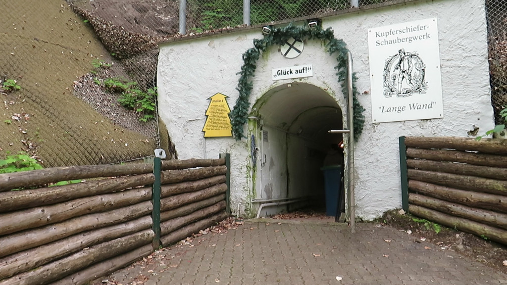
The mine to be visited, “Lange Wand”, is also located along the left banks of the river Bere. At the “Lange Wand” exposure, we first peered through a “window of earth history” and won insights into Permian times. We now can observe aspects of the interior of the earth as it was seen by the miners. Mining activities here probably go back to the 16 th century. Initially, cobalt ore and barite (“heavy spar”) were mined in several tunnels, later to be followed by the excavation of copper shale. At the end of 1860, mining activities were finally terminated. There had been no real economic success during any of the operational periods.
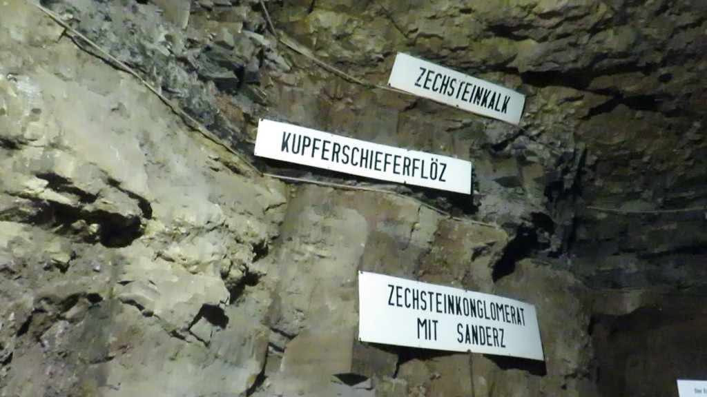
Today, however, thanks to this activity in the past, we are able to observe well developed occurrences of cobalt ore with the so-called “Erz-Rücken” (ore ridge), along with copper ore in the “Kupferschieferflöz” (copper shale layer). We also can view different mining technologies side by side (mining of dikes and mining of ore beds). Processing of the copper and cobalt ores mined in the “Lange Wand” pit took place in two metallurgical plants. The older factory was located near the present paper mill. The second plant, “Johanneshütte”, was built on the territory of the present hotel “Zur Tanne”.
A circular hiking trail, starting at the mine, invites us to discover nature. Be it a weather station, a gold panning site or other interesting offers: there is sure to be something for everyone! School classes in particular make use of the circular hiking trail as a “green classroom”.
The Regionalverband Harz, as one of the managers of the UNESCO Global Geopark Harz ·
Braunschweiger Land · Ostfalen, seeks to make the geology in the Harz region accessible and
understandable. In order to illustrate the geological diversity of the Harz Mountains and their
foothills, a region-wide network of Landmarks and Geopoints has been established. Landmarks are widely visible or particularly well-known locations of the Geopark. Geopoints focus on the geological history of the region. The “Long Wall” Exposure is Geopoint 7 in the area encompassed by Landmark 6 – Poppenberg Tower.


