TL;DR (too long; didn’t read)
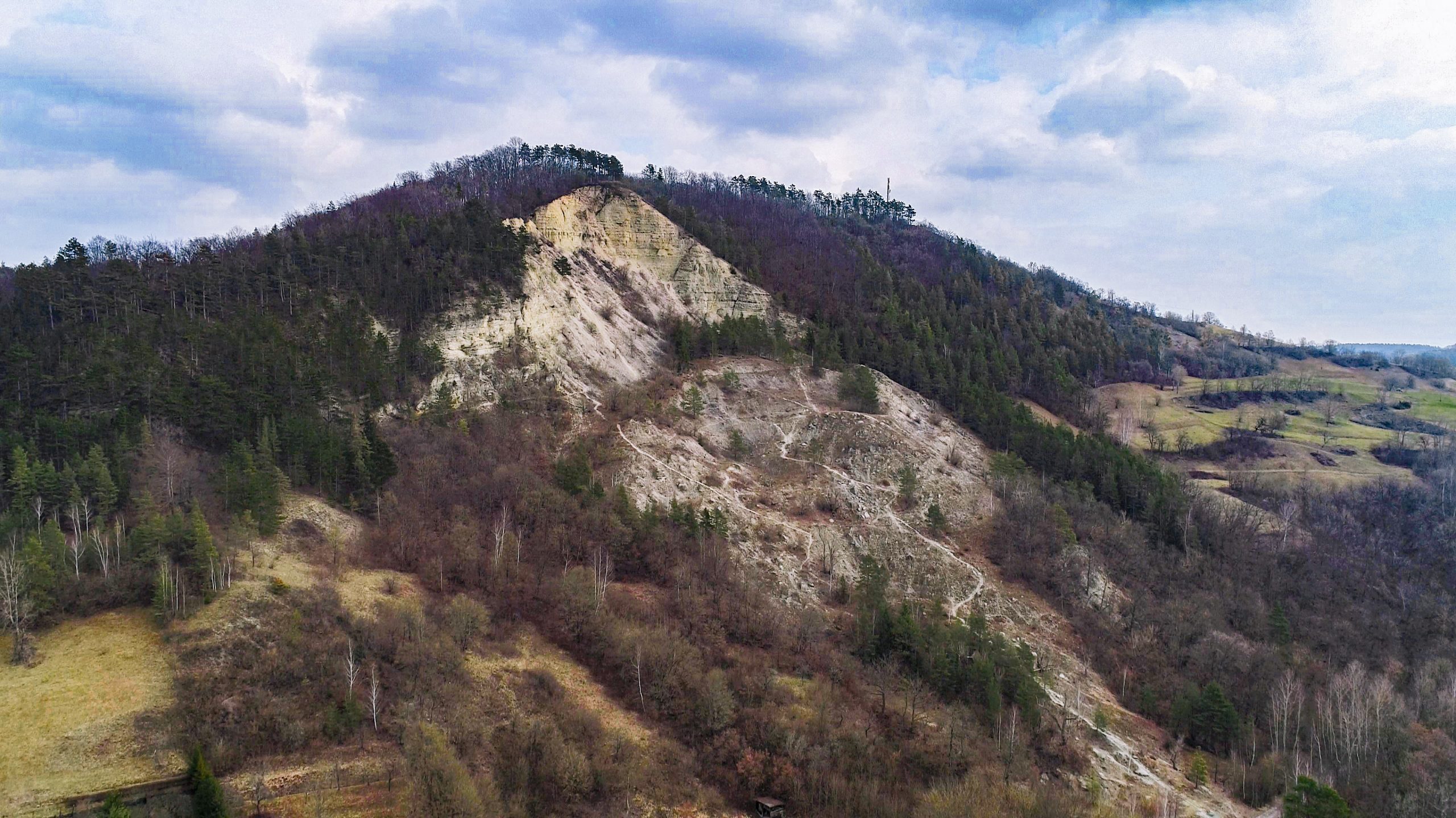
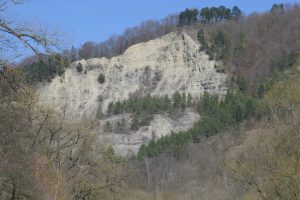
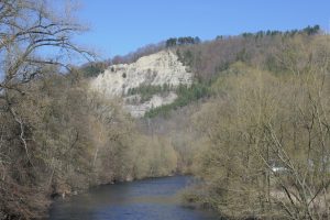
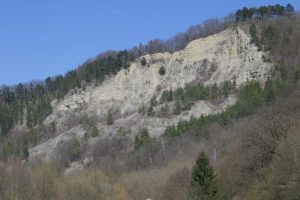
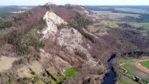
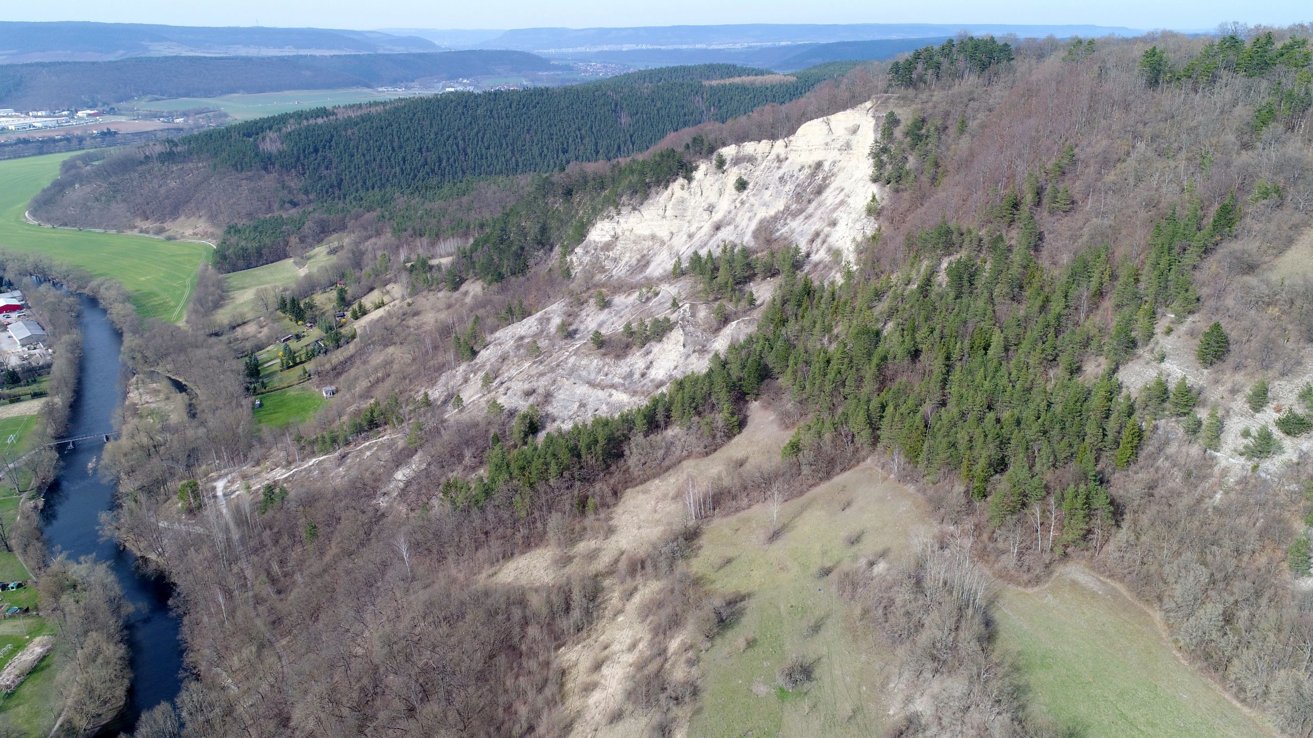
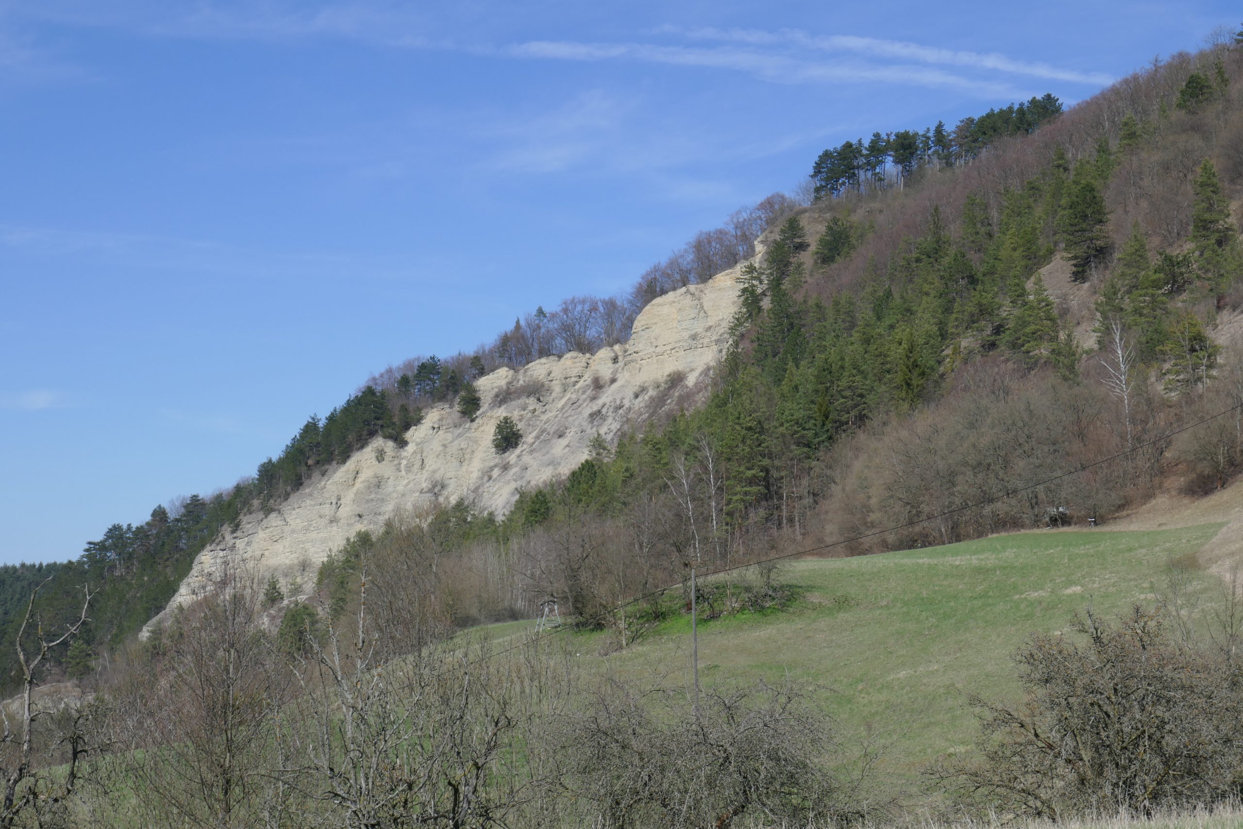
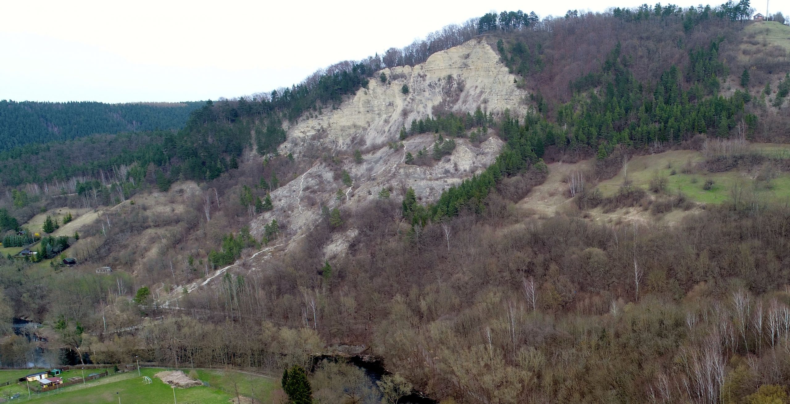
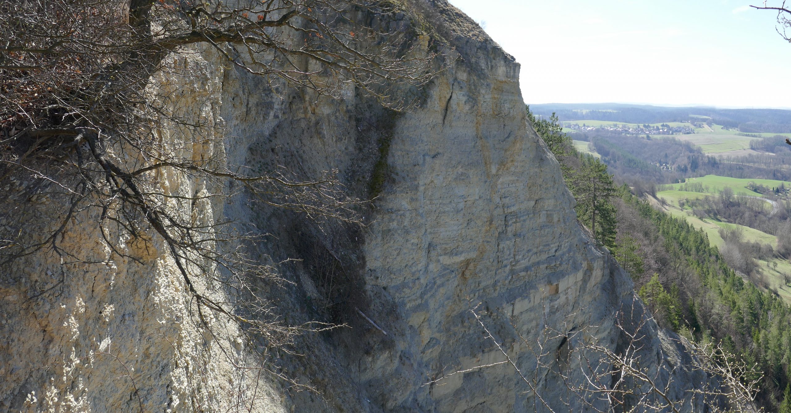
The Dohlenstein is a huge landslide in the Saale valley, which is active since at least 1740. The largest landslides have even changed the course of the Saale river. Here, rocks of the Muschelkalk overlie Buntsandstein units (Triassic). The uppermost layers of the Buntsandstein consist of mudstones. There, water accumulates in the rock and a sliding surface is formed. On this sliding surface the overlying rocks move towards the valley and form a large debris cone. The landslide cliff can be seen from afar as a bright white, vertical rock face.
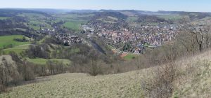
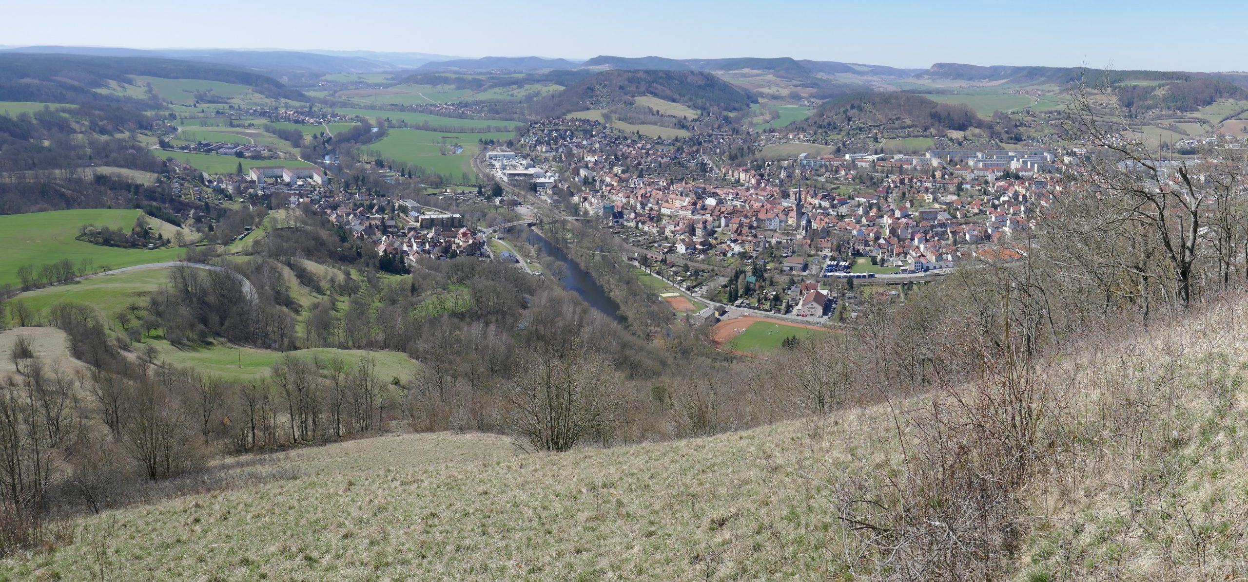
If one follows the picturesque Saale valley between Rudolstadt and Jena, it is impossible to miss the Dohlenstein (Dohle = jackdaw; rock of the jackdaws). Located on the right bank of the Saale River opposite the town of Kahla, the mountain stands 200 meters above the valley. Instead of the otherwise prevailing, rather gentle hills, one sees a bright white vertical rock face at the uppermost part of the mountain. The almost horizontal sediment layers stand out against the dark forest cover. Below, there impressive masses of debris and it becomes immediately clear that this is a huge landslide. With the Leuchtenburg castle towering above the Dohlenstein, this is one of the most spectacular sights that the middle Saale Valley has to offer. But not only the landslide itself is remarkable, also the geological context is highly interesting.
Overview
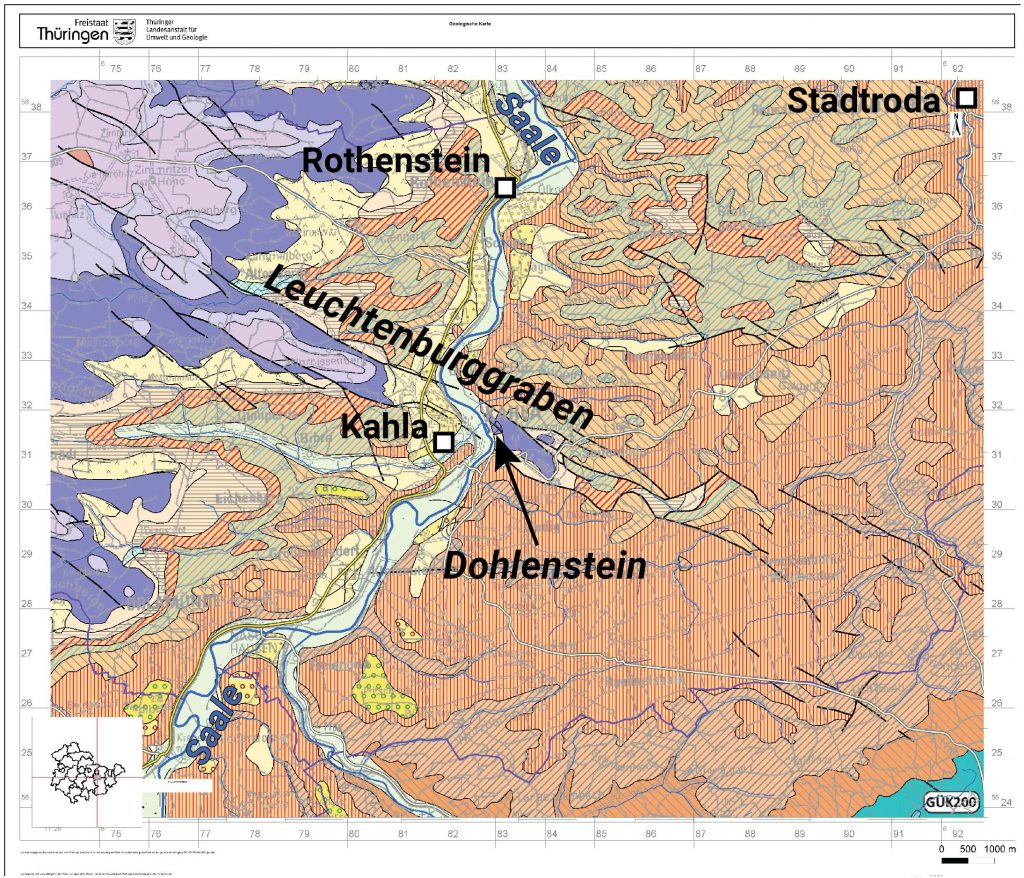
Triassic sediments crop out in the area around Kahla (Fig. 1). The Lower Triassic “Mittlerer Buntsandstein” dominates the Saale valley between Rudolstadt and Jena. These rocks are present between 250.3 and 247.2 million years old. However, the Dohlenstein consists of rocks of the Upper Buntsandstein (247.2-246 million years old) and Lower Muschelkalk (246-243.9 million years old). These rocks should actually be situated far above the Middle Buntsandstein, but today we find them at the same altitude. How did they get there?
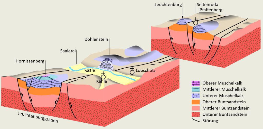
The Buntsandstein was deposited under terrestrial conditions in a rather dry, extensive basin. During the Muschelkalk, marine conditions prevailed. After the deposition of these rocks, not much happened in the area around Kahla, geologically speaking. In the Cretaceous, however, tectonic activity had dramatic consequences: Along northwest-southeast trending fault zones, the Leuchtenburg graben formed with up to 280 m subsidence in its centre (Wagenbreth and Steiner, 1990). This is how the Muschelkalk units came to lie next to the Buntsandstein layers. In the following millions of years, the rocks were subject to erosion. The Muschelkalk turned out to be more resistant to erosion than the Buntsandstein. As a result, the graben now emerges as an elongated ridge in the landscape. This phenomenon is called inverted relief. The Leuchtenburg owes its exposed position to this effect.
Landslide history
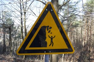
The uppermost units of the Upper Buntsandstein are called Röt and often contain clayey layers. These impermeable clays act as a barrier for the water that infiltrates the rock from above. A lubricated layer forms on which the rocks of the Lower Muschelkalk lying above the Röt can easily slide downhill (Fig. 2) (Johnson & Klengel, 1973; Prinz, 1982). Pre-existing fractures in the rock ease the mobilization of the Muschelkalk units and large blocks tumble or slide down the slope. The visible result is the almost vertical cliff that towers over the valley. In the case of the Dohlenstein, the Saale river also plays an important role. The river has incised deeply into the surrounding lowlands. The Dohlenstein is located on the cut bank of the river. Here, material is continuously removed and carried away. As a consequence, the stability of the slope decreases and at some point the rock masses start to move.
Steiner, 1982))
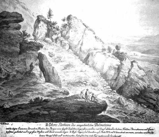
The first reports about larger movements at the Dohlenstein are from the year 1740. In the summer of 1780, the largest landslide took place (Fig. 3). The landslide masses reached the bottom of the valley, and the Saale was forced into a new riverbed in the floodplain. In February 1828, another large landslide occurred, which again shifted the course of the river Saale by more than 10 meters. The last significant movements at the Dohlenstein took place in 1881 and 1920. However, isolated, smaller slides and rockfalls occur frequently. The Dohlenstein was already inhabited in prehistoric times (Balthasar et al., 2011) and is home to flora and fauna worthy of protection due to its special geological conditions (Hilbig, 1971). Visitors can enjoy a breath-taking panorama of the Saale valley from the top of the mountain.
3D models

Ein hochaufgelöstes, wissenschaftlich nutzbares Model gibt es auf V³Geo.
Impressionen


References
Balthasar, P., Brümmer, C., Friedow, S., Gießmann, N., Lux, S., Pasda, C., Scherf, D. & Traufetter, K. (2011): Kahla-Löbschütz–ein Fundplatz des Magdalénien im mittleren Saaletal in Thüringen. Archäologisches Korrespondenzblatt, 41(3), 299-318.
Hilbig, W. (1971): Kalkschuttgesellschaften in Thüringen. Hercynia-Ökologie und Umwelt in Mitteleuropa, 8(2), 85-95.
Johnsen, G., & Klengel, K. J. (1973). Blockbewegungen an der Wellenkalksteilstufe Thüringens in ingenieurgeologischer Sicht. Engineering Geology, 7(3), 231-257.
Kartendienst des Thüringer Landesamtes für Umwelt, Bergbau und Naturschutz (TLUBN) (2021): http://www.tlug-jena.de/kartendienste/
Prinz, H. (1982): Abriss der Ingenieurgeologie: mit Grundlagen d. Boden- u. Felsmechanik sowie d. Erd-, Grund- u. Tunnelbaus. Enke Stuttgart.
Wagenbreth, O., & Steiner, W. (1990): Geologische Streifzüge: Landschaft und Erdgeschichte zwischen Kap Arkona und Fichtelberg. Springer Spektrum, Berlin, Heidelberg.